 |
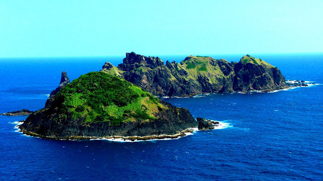
| DOS HERMANOS ROCKY ISLETS LIE OFF CAPE ENGANO IN THE NORTHERN POINT OF PALAUI |
It was a sunny day. We woke up so early from the deep slumber, inadvertently awakened our senses as to what awaits during the day in our Cagayan Valley exploration. Unusual as it may seem, but I easily get used to the early morning breeze and for a long time I got to have a breakfast meal.
At 7AM, our boatman was ready to sail and take us to our much-awaited destination. This is a quest to explore and discover the rich flora and fauna amidst the picturesque seascape and landscape on the island of Palaui.
 Palaui Island lies off the northwestern portion of San Vicente in the Municipality of Santa Ana, Province of Cagayan. As the marker states, Palaui Island is a protected landscape and seascape as per Presidential Proclamation No. 447 issued last August 16, 1994.
Why? This we have to discover.
Getting There
The Port of San Vicente in Santa Ana, Cagayan, situated between Palaui Island and the coast of Luzon is the jump-off point for crossing the channel on Palaui Island. It took almost an hour to be able to reach the northern point of Palaui Island on board our rented motorized outrigger canoe.
At 7 in the morning, we started our journey to cross Babuyan Channel en route to Cape Engano. An environmental fee of fifty pesos (Php50.00) is required for every visitor.
As printed in the day pass, travelers are obliged to behave responsibly while visiting the protected area.
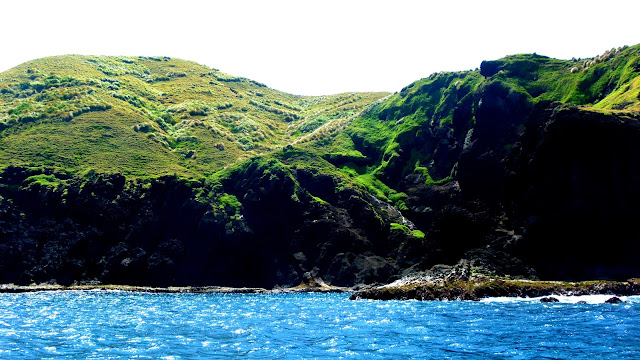
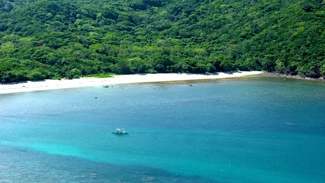
During the initial voyage, the water was calm that we were able to take a lot of photos of the verdant mountains and structures that appear before our sights. It was a magical morning, I said to myself. The varying hues of blue waters appeared before us with the dramatic cliffs that surround effortlessly captured by the lenses of our cameras.
At the middle of the trip, the ride became a roller-coaster amidst the ocean. At first, an instant panic surfaced within us, but subsequently, we became used to it and depended on the great skill of our boatman on how he would maneuver the canoe towards our destination.
Over-all, it was a smooth sailing journey, with a few isolated recurring of huge waves which remains manageable.
As I Wander
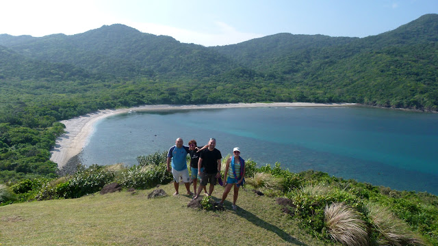
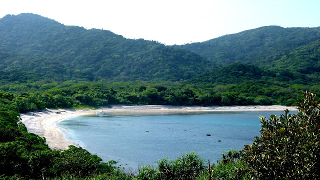
The moment we docked at the northern point of Palaui, we were completely amazed at the magnificent view right before our eyes. The vivid colors of the sea and the mountains was a perfect view, which may be due to the remoteness of the island. We were then warmly greeted by our kind and jolly tour guide (who by the way is also a seasoned photographer, responsible for the great group pictures posted in this blog).
Tour guide is mandatory.
CAPE ENGANO
This is the northern point of the island of Palaui, where we disembarked as the start of our Palaui adventure. On the Philippine map, this is an island off the northeasternmost point of the island of Luzon.
The island is further a witness to the rich history of the Philippines. The name of the island was derived from the World War II battle of Cape Engano, part of the larger battle of Leyte Gulf, although it is said that the battle actually took place some 200 miles to the east in open ocean.
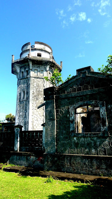
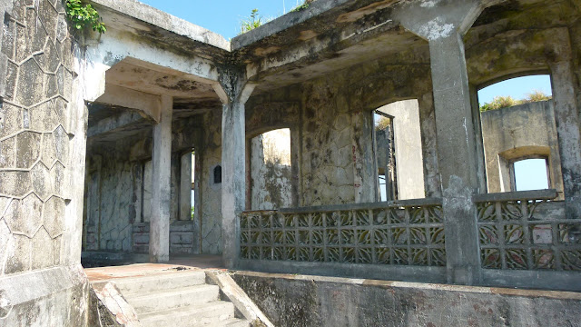
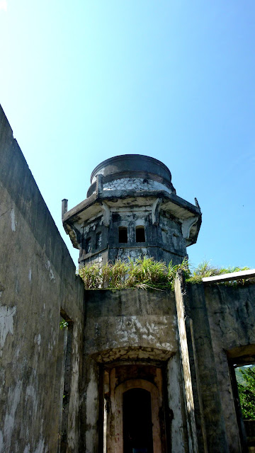
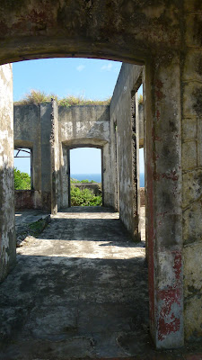
At the summit of the hill stood the ruins of Cape Engano lighthouse. Upon arrival at the cove, I knew this would require another trek adventure, and so we rested for a while to condition ourselves. Though not physically prepared for such, we ventured on the quest to visit this Spanish-era lighthouse.
CAPE ENGANO LIGHTHOUSE
This historic lighthouse located on the summit of a hill in Cape Engano is one of the great remnants of Spanish architecture. It lights the approach from the Pacific to the extreme northeast point of Luzon, and the channel between the Babuyanes Islands and the mainland.
There are several ways to reach the summit. For strong hikers, a hike from Punta Verde, the southeast tip of Palaui, can be made, which takes 3.5 to 4 hours. A local guide would be available for this quest. In our case, we of course opted for the
easiest way, which is to trek for about 20 to 30 minutes from the foot
of the hill.
We started the trek towards the lighthouse together with our guide and with nothing to expect at that time. Concrete steps were paved on the initial steps of the trek, which for me, makes the trek more difficult when ascending.
"No pain. no gain". This must have been the principle of the adventure, for without this involuntary morning exercise, we would not be able to view the 360-degree magnificent seascape of Palaui Island.
On the course of the trek, the secrets of Palaui Island unraveled before our very own senses. On a self note, we are therefore lucky to have witnessed such grandeur of nature.
If only all trails of the trek would provide a panoramic backdrop, then I would be more than willing to do it frequently. What a good exercise indeed!
After twenty (20) minutes of trek, we arrived at our destination.
According to our guide, camping is no longer allowed within the vicinity of the lighthouse.
DOS HERMANOS ISLANDS
The island in Spanish language means "two brothers". These rocky islets lie off Cape Engano and a glimpse of the said island should never be missed once at the lighthouse. Surrounding the islands are the picture-perfect terrains and dramatic rock formations and cliffs that would definitely be good subject for photography. Truly, this is nature at its best.
After hours of roaming around at the lighthouse, our descent now commenced. Being a home to various ecosystems, the contrast of colors and the raw beauty of nature is a usual scenario in this island.
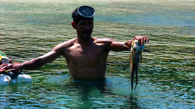 |
| our lunch offered by a fisherman freshly caught in the coves of Engano |
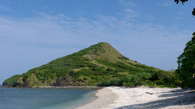
And this is the untouched paradise of the north - Palaui. An ideal site for water sports and mountaineering activities that is truly abundant of marine resources and a home to various endemic ecosystems.
Travel Date: March 9, 2013












15 comments
when we went there, we can't get off the coast of engano so we had to trek 5 hours just to get to the farola (it should've been 2 hours only) because of the muddy trail. but it was fun!
ReplyDeleteblissfulguro- we're lucky enough to have a good weather that day. hehe your experience is great. thanks very much for dropping by. i've been hooked reading ur travel stories recently. hehe
Deleteyour shot at dos hermanos islands is my favorite. i've always wanted to have a similar shot.
ReplyDeletethanks very much.
DeleteMy Palaui trip was epic. I ended up getting a really big swell and the wave was huge when we sailed to Anguib and Palaui One of my scary and bumpy boat ride experiences. :D
ReplyDeletelocals told us that the trip can really be bumpy and scary depending on time of travel. but its all worth it dba? hehe thanks chino for dropping by!
DeleteOi trending to ngayon :) will include Palaui in my list- thanks for sharing :)
ReplyDeletesalamat ng madami. hehe thanks for dropping by! highly appreciated. hehe
DeleteHi,
ReplyDeletePanu kayu nakarting ng sta ana? from manila ba?
also, how did you get the guide?
Thanks!
Dixi
hi dixi, you may click on the Cagayan Travel Guide link on this blog post. thanks!
DeleteWow!
ReplyDeleteParang dinala mo ko sa palaui, atty! Great post!
ReplyDeleteLovely photos! Sama mo ako sa 'next time' :))
ReplyDeleteDid you wear life vest during the boat ride?
ReplyDeleteDid you wear a life vest during the boat ride?
ReplyDelete